Palakkad District - 678104
Monday to Saturday
Department of Geography
INTRODUCTION
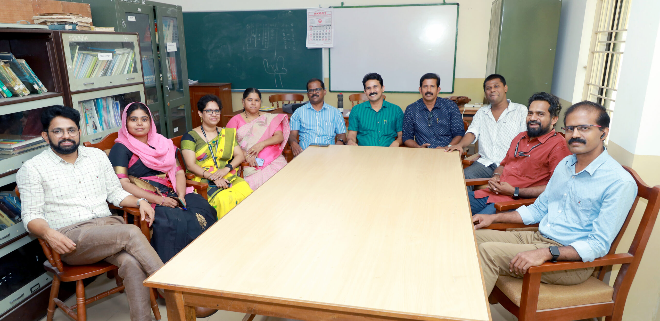
Department of Geography at Government College Chittur was initiated in the year 1972. This is the first Geography Department in Kerala. It is also only Research Center and Post Graduate department in government sector under University of Calicut and is well known for producing one the finest resourceful geographers. The prodigies of department are employed with State Schools at various levels, Central Schools like Kendriya Vidyalaya, Navodaya etc. Some of whom are well placed in International, National and State level organization.
The Department offers Graduation, Post-Graduation, Ph.D. programmes in Geography. Remaining within all the limitations of a normal government college, the department has been able well equip itself modern geographical equipment’s, Remote Sensing & GIS software’s, ICT based classroom to enhance the skills and learning experience of the students.
Living under the hard circumstances socially and economically, 40+ students of the Department have proved their metal in clearing the UGC-NET / CSIR / Sate Eligibility Test (SET) / Kerala Public Service Commission and Union Public Service Commission Examinations and securing very good career opportunities.On completion of graduation / post gradation, students tend opt for higher studies programme at various national and international institutions. Some of the alumni of this department are research scholars or undergoing higher professional’s programmes like planning in prestigious institutions like TISS, CEPT, SPAs etc.
The department also has been very active in supporting the local community and further contributing to the society by sharing knowledge be it assisting local governments or farmers.
The faculty level expertise includes Agricultural Geography, Geomorphology, Health Geography, Social Geography, Spatial Planning, Rural and Urban Planning, Geographic Information System, Watershed Management, Cultural resources conservation and Management being the prominent. The faculty have been involved in research and extension activities as well. Some of the faculty have also been able gain international exposure, while few other are contributing as members of state or district level committees.
The department has been in forefront of providing assistance to local self-governments in GIS base asset mapping which is a project of Panchayati Raj and Rural development Ministry of Government of India. The Department has been responsible for organising capacity building sessions for panchayat officials on mobile based assets mapping application. The Department is actively involved in capacity building and training of Agricultural officers in using GIS as a mapping tool for various activities. In Association with Regional Agricultural Technology Training Center, Malampuzha, the Department faculty has trained about 300+ Agricultural officers.
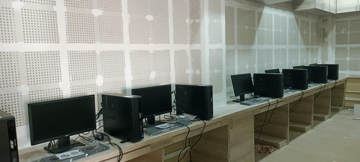
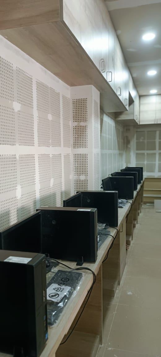
Computer Lab(GIS)
FACILITIES
Geographic Information System Laboratory
The department’s Geographic Information System laboratory is equipped with 17 state of the art computer systems. The GIS lab is equipped with 34 licensed professional GIS software and 11 licensed remote sensing image analysis software. These were acquired under DST-FIST Programme funding.
GNSS Station
The department was able to acquire GNSS station a modern surveying instrument commonly used for high accuracy surveying in geographic research. Acquisition of this intrucment put Department of Geography way ahead of its compatriot geography departments in Kerala in ensuring students gain skills in using best of the modern instruments.
Aquameter
Modern geophysical survey instrument for groundwater potential mapping. This has enhanced the extension activities of the department and help the local community as well as communities in research study areas of faculty members. The faculty have been able to help farmers in Kambam-Theni, Periayakulam in Tamil Nadu as well as in Bidar and Bijapur to locate groundwater potential sites for irrigation. The instrument is also used as part of Resource Mapping Practical exercise to equip students from career and research perspective
Total Station
The department was able to acquire modern survey equipment Total Station under DST-FIST Programme funding. Total station survey is part of Post-Graduate practical course. The instrument is also utilized for research work.
Other Facilities
The department is well equipped with water and soil quality analysis equipment’s as well. Above this traditional surveying equipment’s like theodolite, dumpy level, plain table, prismatic compass, Indian clinometer, Auto level etc. are brought into use for skill development of students at graduate and post-graduate level.
PROJECTS
Major Project
| # | Project Title | Principal Investigator | Year | Project Funding |
| 1 | Mapping Spatial Distribution of Quarries in Malappuram District | V Govindankutty | Principal Investigator | 2020-2021 | DoECC, Government of Kerala |
| 2 | Assessment of Biodiversity loss Along the Flood and Landslide Hit Areas of Attapady Region | Dr. Richard Scaria | 2019 | Kerala State Biodiversity Board | |
| 3 | Flood Zone Mapping and Hazard Management of Palakkad District | Dr. Richard Scaria | Project Coordinator | 2018 | Haritha Kerala Mission, Government of Kerala |
| 4 | A geographical Analysis of women living with HIV/AIDS in Kerala – A GIS Approach to public health planning | Dr. Jayarajan K | Principal Investigator | 2018 | ICSSR |
| 5 | Health Care Disparity of Kerala | Shri. Prasad K | Principal Investigator | 2015 | UGC |
| 6 | Mapping historic qanat system landscape of bidar-karnataka | Shri. V Govindan kutty | Principal Investigator | 2017 | |
| 7 | Jalkranti Abhiyan- Integrated water security plan of Vadakarapathy Panchayat, Palakkad | Dr. Richard Scaria | Project Coordinator | 2017 | Local Self Government Department of Govt. of Kerala |
| 8 | Rehabilitation of Land to Landless tribes in Attapady, Palakkad | Dr. Richard Scaria | Project Coordinator | 2016 | Revenue Department, Government of Kerala |
| 9 | Gap in Government welfare programmes in Attapady, palakkad | Dr. Richard Scaria | Project Coordinator | 2016 | Kerala Women’s Commission |
| 10 | A Medico Geographic analysis of HIV/AIDS in Kerala – A case study of plakkad district | Dr. Jayarajan K | Principal Investigator | 2013 | UGC |
NATIONAL SEMINARS / WORKSHOP / EXPERT LECTURES
The Department has been availing opportunities provided by University Grants Commission and Directorate of Collegiate Education to enhance the capacities of both faculty and students. Seminars, Workshops and Expert Lectures are organized by picking up appropriate topics of current relevance.
| Sl. No | Seminar/Workshop | Date | Funding Agency |
| 1 | National Workshop on Spatial Information Technology for Natural Resource Management-GEOTECH 2012 | 12/03/2012- 13/03/2012 | DCE |
| 2 | National Workshop on Spatial Information Technology for Rural Planning-GEOTECH 2013 | 7/10/2013-
11/10/2013 |
DCE |
| 3 | National Workshop on Spatial Information Technology for Watershed Management-GEOTECH 2014 | 27/10/2014-
31/10/2014 |
DCE |
| 4 | National Seminar on Climate Change Trends, Impacts and Implications | 28/01/2015-29/01/2015 | UGC |
| 5 | National workshop on Geo-spatial Technology for Resource Mapping-GEOTECH 2015 | 01/12/2015
05/12/2015 |
UGC |
| 6 | National Seminar on | ||
| 7 | National Seminar on Water Culture-Every Drop Counts | 05/12/2017-07/12/2017 | DCE |
| 8 | Two Day National Seminar on Exploring the possibilities of secondary data sources in social science research | 13/09/2018
14/09/2018
|
DCE |
| 9 | National Workshop on “Land, Geomatic and Geophysical Surveying | 16/12/2019- 20/12/2019 | DCE |
Faculty List
| SL NO | NAME | DESIGNATION | FACULTY PROFILE |
| 1 | Dr. JAYARAJAN.K | Associate Professor & HOD | View here |
| 2 | SURESH .P | Asst.Prof. | View here |
| 3 | Dr. PRASAD. K | Asst.Prof. | View here |
| 4 | Dr. RICHARD SCARIA | Associate Professor | View here |
| 5 | Dr. ROOBINA .A | Asst.Prof. | View here |
| 6 | NAZRIN BEGUM .S | Asst.Prof. | View here |
| 7 | PANKAJAKSHAN.P | Asst.Prof. | View here |
| 8 | Dr. SUDEEP.T.P( Transferred) | Asst.Prof. | View here |
| 9 | VINEESH.V | Asst.Prof. | View here |
| 10 | Dr. RESHMA C U | Asst.Prof. | View here |


